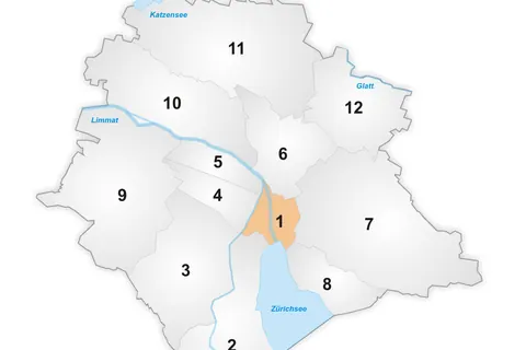
The Altstadt in the Swiss city of Zurich encompasses the area of the entire historical city before 1893, before the incorporation of what are now districts 2 to 12 into the municipality, over the period 1893 to 1934. Die Altstadt approximately corresponds to the area enclosed by the former city ramparts, and is today within the administrative area of the city called Kreis 1.
With a population of 5,617, it houses about 1.4% of the city’s total population.
Administratively, District 1 is divided into four parts or quarters by the Zurich statistical office, Rathaus, Hochschulen, Lindenhof and City. Lindenhof and Rathaus correspond to the parts of the medieval city left and right of the Limmat, respectively, while City and Hochschulen include the area of the Early Modern city west and east of the medieval walls, respectively.
Places in the district
- Fraumünster70 m
- Grossmünster150 m
- St. Peter160 m
- Paradeplatz240 m
- Bahnhofstrasse300 m
- Lindenhof340 m
- Bürkliplatz360 m
- Kunsthaus Zürich460 m
Sources
Text: introduction of the Wikipedia article Altstadt (Zurich), under the CC BY-SA 4.0 licence (authors: article history). Facts: Wikidata (CC0). Coordinates: Wikidata, map background © OpenStreetMap contributors.